
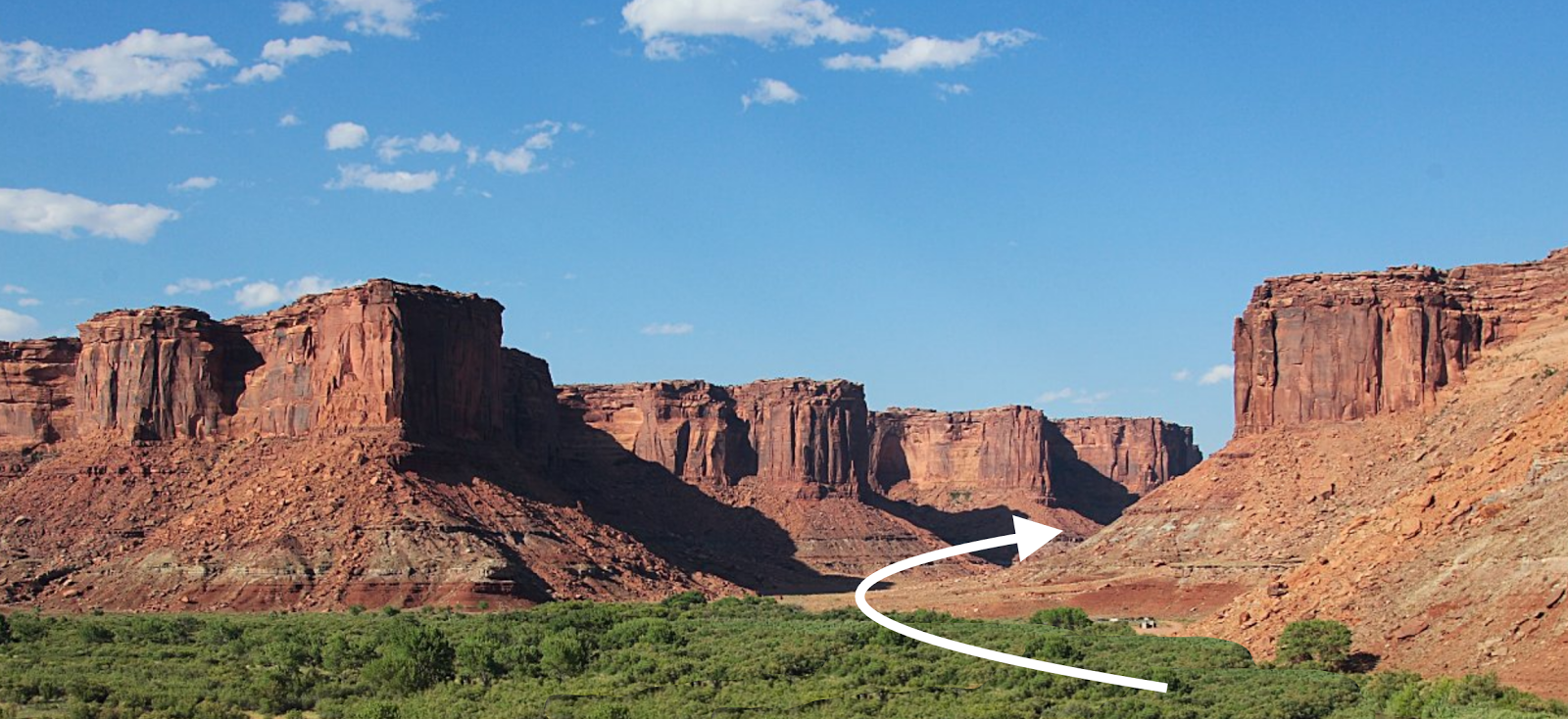
When entering into a restricted
line-of-sight area, such as a canyon, mountain pass, etc., one’s view to right
and left is considerably restricted and often it cannot be determined what is
beyond what can be seen
Another point to make is that Sorenson argues that “it would be unreasonable for Limhi’s explorers, desperately searching for rescue for their enslaved people, to continue far beyond where they thought Zarahemla would be,” and also states: “so by the time they had gone, say, twice as far as the normal distance to Zarahemla, they must have wondered about their position and probably would not have gone much farther.” Now, this leads to a total misunderstanding on the part of Sorenson, as it does with numerous other theorists, and that is this expedition was not moving in a more or less straight line away from the city of Nephi, nor did they know how far they had traveled since they were lost and were wandering about as it is stated: “And they were lost in the wilderness for the space of many days” (Mosiah 8:8). When people are lost and wandering around, they do not know how far they have traveled, other than in time, and have no knowledge of the distance they had gone away from their starting point, obviously because they do not know where they are.
Yet, as though trying to tell us that lost people knew where they were, Sorenson goes on to claim: “If it is on the order of 180 miles from the city of Nephi to Zarahemla, it would be strange if the explorers pressed on for hundreds or thousands of miles beyond that. Sorenson suggests that at most they would have gone about twice again as far—say around 200 miles north of Zarahemla. Even if we double this estimate again (likely a huge overestimate), it leaves the land northward only 400 miles north of Zarahemla.”
Again, the point is, these people did not know where they were, did not know how far they had traveled from the city of Nephi, did not know if they were in the realm of the Land of Zarahemla, etc., etc., etc. In fact, when they finally reached the Land Northward and found the Jaredite remains, they thought they had finally reached the city and area of Zarahemla. As it states: “Now king Limhi had sent, previous to the coming of Ammon, a small number of men to search for the land of Zarahemla; but they could not find it, and they were lost in the wilderness. Nevertheless, they did find a land which had been peopled; yea, a land which was covered with dry bones; yea, a land which had been peopled and which had been destroyed; and they, having supposed it to be the land of Zarahemla, returned to the land of Nephi, having arrived in the borders of the land not many days before the coming of Ammon” (Mosiah 21:25-26, emphasis added).
The point is, theorists forget or overlook what the scriptural record tells them and begin making up their own understanding and definition of events, typically to fit their own ideas of distances, to which Sorenson’s entire ten pages on this matter are devoted as he tries to justify an extremely limited Land of Promise when the scriptural record does not validate his speculations.
However, the major point here is that all these theorists want to use this expedition to prove their point about the width of the narrow neck and the impossibility of Limhi’s forty-three men rescue mission not knowing they had passed through the narrow neck of land in their lengthy trek and thus, according to them, the narrow neck could not have been very narrow.
The problem is at least two-fold: 1) Assuming the Limhi expedition did not know they were traveling through a narrow neck of land, and 2) Assuming the Limhi expedition would have seen that they were traveling through a narrow neck of land. That is to say, first, the scriptural record does not tell us whether or not they traveled through a narrow neck, whether or not they saw they were traveling through a narrow neck and knew it, or whether they were totally unaware that they had traveled through a narrow neck, which they would have had to do twice to get into the Land Northward and then travel back into the Land Southward. Thus, an assumption is made about the narrow neck the scriptural record does not answer or suggest.
Second, the scriptural record does not provide us with enough information to know whether or not when one, not knowing there is a narrow neck of land, passes through the narrow neck that they would know it from sight, i.e., actually be able to see and know that they were doing so. Thus, an assumption would have to be made that if they had no prior knowledge of a narrow neck, and their view of the terrain to east and west was impaired that they would still know they were passing through the narrow neck.
By way of a personal example, I have driven all over this country and elsewhere, and often in areas I have never before been. Without consulting a map of a larger area, I have often driven through areas with mountains, cliffs, uplifts, etc., on both sides of the road that did not afford a view to right or left, sometimes for several miles, and when I had passed through, had no idea what was to the right and left beyond my line of site.

When passing through areas where
vision is restricted to right and left, it is not always possible to know what
lies beyond one’s line of sight; in such cases, vision can be restricted to
anywhere from a few hundred yards to a mile or two and no further

Left: Original roadwork through the
gorge in the early 1970s; Right: the road today. Note how difficult it is to
see to the right and left of the road since vision is blocked by the
surrounding cliffs and mountains
I have traveled through this Gorge at least fifty times, and though it is considered the most scenic route in all the state and region, I still have no idea what lies just a scant mile or two on either side of the route beyond the cliffs since there is no way to glimpse it during those 12 miles. There could be a deep canyon, a winding river, an ocean, a valley, or just a long series of mountain peaks, and I would not know it since there is no possibility of a line of sight view of what lays beyond the cliffs along the road.

Left: DeBoque Canyon; Right: Glenwood
Canyon; both in Colorado along I-70). Note the lack of line of sight to either
side of the road
There is no mystery in this, merely a lack of knowledge on the traveles’ part as to where they were and how they were going to get where they wanted to go, or even where the place was they were trying to reach--after all, it had been three generations since Zeniff led his colony out of Zarahemla to the City of Nephi.
When Ammon, taking a different route, traveled from Zarahemla to the city of Nephi, he was lost and wandered about for forty days, the same for Zeniff and his group originally. When you are reliant upon finding a pass to get through mountains, etc., it is not always a simple matter. Travel in virgin lands is more of a happenstance than planned achievement, as most explorers report. It is far different than our form of travel today. They didn’t have topical maps, aerial views and satellite photos to consult to know what was around them.
To believe someone traveling through a narrow pass (Alma 50:34; 52:9; Mormon 2:29; 3:5) is automatically going to be able to see in both directions to right and left is typically unrealistic as is knowing they were traveling through a narrow neck of land without prior knowledge of the terrain.


No comments:
Post a Comment