

The word “Repliancum” was evidently a word in the Jaredite language that meant “very large,” or “to exceed all” in size. It also appears from the abridgement of Ether’s writing that Moroni has given us, that the Jaredite language did not use phrases like “Sea East” or “North Sea,” since there is no such wordage in the record.
Evidently, the Jaredites referred to the noun “sea” by itself, giving a description of location to place it, such as “sea in the wilderness” (Ether 2:7), or by its size, such as “great sea that divideth the lands” (Ether 2:13), when referred to the ocean—which evidently is how Ripliancum was used, i.e., The Great Sea.
They also used the term “seashore” (Ether 2:13; 9:3; 14:12-13, 26). And they seem to have used the term “sea” as we would use “ocean” (Ether 2:24-25; 3:4; 6:4-6,10), which was pretty common for the time. In addition, they used the term “waters,” as did Lehi, when he called the sea Irreantum, meaning “many waters” (1 Nephi 17:5). In Lehi’s case, he was referring to the ocean itself, which is now called by many names in that area (Sea of Arabia, Indian Ocean, Southern Ocean, Pacific Ocean, etc.), where several different bodies of water are connected into one overall water mass. If the Jaredites had the same meaning, which the term “very large,” or “to exceed all,” would also apply, then we can consider Ripliancum was one body of water connected to numerous others. In this case, Ripliancum would be part of the great ocean of the world, which not only would make it the same term the Nephites applied to it when they called it the Sea North (Helaman 3:8).
This also seems to be the term used in “waters of the Red Sea” (Helaman 3:11), a body of water that opens into the Sea of Arabia, Indian Ocean, etc.; as in “the great waters” (Ether 6:3), meaning the ocean

In addition, they used the terms “fish of the waters” (Ether 2:2), meaning any waters for fish are almost everywhere, or “after the waters had receded” (Ether 13:2), referring to the waters that covered the Earth during the Flood. The term also seems to have applied to “an abundance of water” as used in “encompassed about by many waters” (Ether 6:7).
So when they “came to the waters of Ripliancum,” we might infer this was not only a large body of water, but one connected to other waters, as their North Sea would have been—after all, Jacob made it clear that the Land of Promise was an island in the midst of the sea over which they had sailed in Nephi’s ship (2 Nephi 10:20). This is borne out in Helaman’s statement when describing the Nephite expansion during a time of immigrating to all parts of the land, when he said, “they did multiply and spread, and did go forth from the land southward to the land northward, and did spread insomuch that they began to cover the face of the whole earth, from the sea south to the sea north, from the sea west to the sea east” (Helaman 3:8).
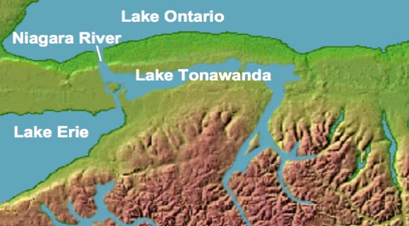
Consequently, it seems clear that when the term “sea that divides the land” (Ether 10:20) was used to described an obvious separation of the lands, that this sea was part of a larger connection of water such as is seen in the Bay of Guayaquil in Ecuador, which separated the Land Northward from the Land Southward, and was not some small, isolated water, like a small lake as the ancient Lake Tonawanda.
However, this is not necessarily the meaning of the “sea that divides the land,” for all it means is that the land was divided, it does not state by what type of water source, in what size, shape, or purpose. However, elsewhere we are also told about land divisions. As an example, the Land of Nephi was divided by a narrow strip of wilderness from the Land of Zarahemla, meaning the Nephites and the Lamanties were divided by this narrow strip of wilderness (Alma 22:27; 27:14); we are also told that the land was divided by a narrow neck of land that separated the Land Northward from the Land Southward (Alma 22:32). In the case of the sea division, it also divided the land Northward from the Land Southward where the narrow neck of land was located (Ether 10:20). In all these cases, a separation of land is involved.
Consequently, if we look at the narrow neck of land, we should find two seas, one on either side (Alma 50:34), which obviously means that an incursion from the sea on either one side or the other or both is the separator, i.e., the sea is what separates the land—the narrow neck merely joins those two lands.

Thus, any infringement of the sea into the land, such as a large bay, would certainly be recognized as a “sea that divides the land,” especially if that division was the same as earlier mentioned in what divided the Land Northward from the land Southward, and was on one or the other or both sides of the narrow neck of land, which formed a passage that provided movement between the two land masses. This, obviously, is why the place was chosen as the point of division for the treaty between the Nephites and Lamanites in the latter years of the war in 350 A.D. (Mormon 2:28). It was a natural dividing point, one which Mormon hoped would give the Nephites some security from Lamanite invasion since it provided a natural defensive position.
Consequently, this is not a separate sea that divides the land, but a part of the sea that separates two land masses, leaving just a narrow neck and passage between the two lands. As a result, when the Andes Mountains came up, fulfilling Samuel the Lamanite’s prophecy of valleys that would become mountains “whose height is great” (Helaman 14:23), the sea on the east was pushed back eastward into what today is called the great Amazon Basin—an area that is mostly just below sea level and is the largest such drainage basin in the world.

Thus, we have a portion of the sea that surrounded the "island" Jacob mentioned, the four location seas Helaman mentioned, and a portion of that sea that actually separated or divided the land masses of the Land Northward and the Land Southward.


No comments:
Post a Comment