Monday, September 30, 2013

The Narrow Neck of Land One More Time – Part XII—Mesoamericanists’ Achilles Heel

Continuing from the last posts showing the fallacy of the Mesoamerican Theorists’ view of the Isthmus of Tehuantepec in being the narrow neck of land—it becomes clear that this isthmus is the real Achilles heel of every Mesoamerican model. In pursuing this, the following is from John E. Clark, himself a Mesoamericanist and follower of John L. Sorenson’s model, in which he defends the Mesoamerican Theory.
Clark’s arguments continue:
14. “The description of poisonous snakes blocking passage to the land southward in Jaredite times is one of the more unusual claims in the Book of Mormon. I agree with Warr that the incident indicates warm climes and favors the interpretation of the narrow neck as an isthmus rather than a corridor. Beyond this, there is not much that we can wring from this description. John Tvedtnes suggests that the snakes could have been associated with drought and infestations of small rodents, something that could have occurred in either area. Poisonous snakes are probably prevalent in both proposed areas. For now, this criterion does not favor either proposal. For his part, Allen reads these passages metaphorically to refer to secret societies; he claims that a literal reading is nonsensical.”
Response:  First of all, the Children of Israel were being bitten and killed by a huge  number of snakes, so many in fact, that they infested the tens of thousands of Israelites in the wilderness (Numbers 21:6), which should suggest that the Lord has used snakes for his purposes more than just in the Book of Mormon. Secondly, a warm clime would fit Mesoamerica, the Rivas Isthmus, and also the Bay of Guayaquil in Ecuador, South America (nearer the Equator than the other two), so that idea is not helpful for a location. Secondly, there is nothing about the event that suggests an isthmus over a corridor. However, the word isthmus (defined as “a narrow strip of land with sea on either side, forming a link between two larger areas of land”) certainly seems to be more accurate than corridor; however, since this narrow neck of land had a “narrow passage” (Mormon 2:29), a synonym of corridor is passage, but not pass, which this area is also called by Mormon (Alma 50:34, 52:9). So why don’t we stick with Mormon’s term “neck of land,” rather than inserting Isthmus, especially since Mesoamericanists and James Warr both prefer that term because their models are called an Isthmus (of Tehuantepec and of Rivas).
As for “one of the most unusual claims,” perhaps we should consider the purpose of this action—it kept the Jaredites from entering the Land Southward (Ether 9:32-33). Evidently, the Lord did not intend for the people to do so, and the snakes were his way of keeping the Jaredites in the Land Northward “but that they should  hedge up the way that the people could not pass” (Ether 9:33). And as for “John Tvedtnes suggests that the snakes could have been associated with drought and infestations of small rodents,” certainly this was because of drought, since their was “a great dearth upon the land, and the inhabitants began to be destroyed exceedingly fast because of the dearth, for there was no rain upon the face of the earth” (Ether 9:30). Since a dearth is a lack of something, and there was no rain upon the land, one would normally consider that a drought. And with a lack of rain, this usually leads to a lack of food crops, so there was a famine. This is not rocket science, and John Tvedtnes making the statement that “the snakes could have been associated with a drought,” and Clark even quoting that, seems on the ridiculous side. Certainly the idea of rodents, since there is no mention or suggestion of such in the scriptural record, is equally ridiculous to bring up. But as long as it was brought up, one of the favorite meals of large snakes is small rodents, so it is not likely they would have escaped the horde of snakes, and meaningless to bring up. The point is, it is not wisdom to invent ideas not specifically mentioned or suggested by the scriptural record—it does nothing for the student of the scriptures, and often creates a false knowledge that serves little or no purpose.
15.  “A careful reading of [Ether 9:35] may cause questions to arise. Neither serpents nor flocks behave in the manner described here. That is, poisonous serpents do not pursue animals; they defend themselves against intruders including animals.”
Response: The key here is the term: “The Lord did cause the serpents that they should pursue them no more” (Ether 9:33), which should suggest that the Lord caused the serpents to pursue them in the first place. Most importantly, we need to understand that neither Mormon nor Joseph Smith used the term snakes, but serpents. A serpent is a large snake, and if large enough, many animals would move away from them. If the serpents were inclined to attack, an attitude that could have been installed in them by the Lord, the animals would have fled. This brings to mind when “the Lord sent fiery serpents among the people and they bit the people” and the Lord told Moses hold up the pole with a brass serpent on it (Numbers 21:8). It seems to me that there are no questions that need arise. We need to trust in the prophets who wrote the scriptural record, and know that nothing is too difficult for the Lord (Jeremiah 32:27).
16. “Additionally, if in reality the flocks represent sheep or cattle, it is contrary to the way these animals react. They simply do not travel hundreds of miles just to get away from snakes…If the serpents and flocks represent groups of people instead of animals, the scripture in Ether 9:31 takes on an entirely different meaning. The poisonous serpents may be symbolic of the secret combinations, which did "poison many people" (Ether 9:31). This is exactly how secret combinations work. They spread their deadly poison among the people. They draw them away by false promises for the sole purpose of obtaining power over the masses and to get gain. Hence, the flocks could represent a righteous group of people who retreated to the Land Southward to escape the wickedness that had come upon the land. The word "flocks" is used in many instances in the scriptures to represent a righteous group of people. Indeed, the Savior is the Good Shepherd who watches over His flocks (Alma 5:59 60).”
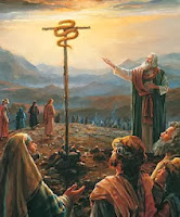
Response: This is very imaginative and reminds me of types of Sunday School discussions that stray far afield of the scripture under discussion. On the other hand, most scripture is symbolic and meant to point one toward Christ. Unfortunately, that is no interpretation in the scriptural record to suggest such a  meaning. And certainly the fiery serpents mentioned in Numbers was tied directly into the pole and serpent Moses held up, since the pole and serpent, when looked upon, saved the people, which is an obvious suggestion of how looking upon Christ, the one that was lifted up on the cross, results in our salvation. In this quote Clark attributes to Joseph Allen’s book, evidently Clark and I agree since he goes on to state: “There is no indication in the text that this verse should be read metaphorically to refer to secret combinations.” In addition, we might consider that the Lord, who controls all things, evidently wanted flocks, herds, etc., to enter into the Land Southward during Jaredite times, so they would multiply and cover the Land Southward for the future needs of the Lehi Colony and the Nephite nation. It is always amazing when people start limiting what the Lord can and does do to further his plans.
17. “In discussions of Nephite demography…it is now commonplace to make the observation that Lehites and Mulekites were not alone on the continent. The same was true for the Jaredites.”
Response: It is certainly commonplace among those who champion Mesoamerica as the Land of Promise site. However, and once again, since there is not a single reference of any kind in the scriptural record that the Land of Promise was occupied by anyone other than Lehi’s family, the Jaredites before them, and the Mulekites, it seems less than prudent to keep harping on the unfounded belief that the area described in the Book of Mormon was occupied by anyone between the Flood rescinding and the coming of the Jaredites and later the Lehi colony. Those who do so sound like the proverbial "used-car salesman" of an earlier era who kept telling tall tales about his product that eventually the customer believed him. Such an approach falls under the also proverbial statement that come out of World War II, "if you tell a lie often enough it will be believed." There simply were no other people in the Land of Promise according to all the prophets who wrote about their land. Of course, it is completely self-serving for Mesoamericanists to keep claiming this.
(See the next post, “The Narrow Neck of Land One More Time – Part XIII—Mesoaermicanists’ Achilles Heel,” for more on this difficult area for the Mesoamerican Theorist model to reconcile with the scripture)

Sunday, September 29, 2013

The Narrow Neck of Land One More Time – Part XI—Mesoamericanists’ Achilles Heel

Continuing from the last posts showing the fallacy of the Mesoamerican Theorists’ view of the Isthmus of Tehuantepec in being the narrow neck of land—it becomes clear that this isthmus is the real Achilles heel of every Mesoamerican model. In pursuing this, the following is from John E. Clark, himself a Mesoamericanist and follower of John L. Sorenson’s model, in which he defends the Mesoamerican Theory.
Clark’s arguments continue:
12. Before leaving this issue, it is worth mentioning that some proposals narrow the distance across the neck by suggesting raised sea levels in Book of Mormon times. M. Wells Jakeman and his principal disciple, Ross T. Christensen, argued that in Book of Mormon times the seas came much farther inland in the Isthmus of Tehuantepec, thus significantly reducing the width of the narrow neck at this place. Jerry L. Ainsworth's recent proposal adopts this line of argument. Archaeologically, though, we know of early and late sites near the current beach lines, so the ocean margins must have been at their current positions by about four thousand years ago, with only minor fluctuations of a meter or two since then. In short, recourse to catastrophic geology will not do for slimming the Isthmus of Tehuantepec. I learned this theory as an undergraduate from classes I took from Jakeman and Christensen”
Response: J. Wyatt Durham (left), considered a giant in the field of paleontology by his peers, spent four years in Colombia as Chief Paleontologist for Tropical Oil Company and two years as Associate Professor at the California Institute of Technology. During his early years on the Berkeley faculty he became known for his seminal systematic studies of West Coast tertiary faunas. According to Durham, in “Evidence of No Cenozoic Isthmus of Tehuantepec Seaways,” wrote that back in 1905, Böse claimed that there were no seaways that crept up onto the Isthmus of Tehuantepec;  however, because of its narrowness and low divide, the Isthmus has caused much speculation and discussion regarding possible seaways between the Atlantic and Pacific oceans, though several subsequent authors insisted on such a connection. So a re-examination of the Isthmus region made by several paleontologists clearly indicate that no Cenozoic seaways have crossed it and no post-Cretaceous marine sediments are present on the Pacific side of the continental divide, nor are there any marine terraces on the extensive Tehuantepec plain, contrary to earlier authors.” The Cenozoic Era (meaning new life), is the current and most recent of the three Phanerozoic geological eras, and covers a period from 66 million years ago to the present.
It is one thing to point to geologic studies that show something existed in the past, and quite another merely to say something existed at one time. It should also be understood that “The Yucatan Peninsula is a carbonate platform and uplifted anciently, and before the Central American isthmus was raised, the region had been completely underwater. The islands of the West Indies delineated a submerged former land bridge which had connected North America and South America via what are now Florida and Venezuela.” At that time, areas of Mexico's coastline on the Gulf of California, the Baja California Peninsula, are riding northwestward on the Pacific plate. Rather than one plate subducting, the Pacific and North American plates grind past each other, creating a slip fault that is the southern extension of the San Andreas fault in California. Motion along this fault in the past pulled Baja California away from the coast, creating the Gulf of California. Continued motion along this fault today is the source of earthquakes in western Mexico.
As for raised sea levels, all of the models suggested by geologists were based on the land mass rising or sinking, not on a change in sea level. The deep ocean drilling ship Glomar Challenger, under the auspices of the Joint Oceanographic Institutions for Deep Earth Sampling (JOIDES), which consisted of over 250 distinguished scientists from academic institutions, government agencies, and private industry from all over the world, drilled extensively along both coasts of Panama in the latter half of the last century. While they found that the isthmus was once underwater and rose to form a connection with South America, they found no indication of rising or lower sea levels.
13. [James] Warr muddies the water…by claiming "that the inhabitants considered their land an island." What the book says is that "the land of Nephi and the land of Zarahemla were nearly surrounded by water" (Alma 22:32), being an "isle of the sea" (2 Nephi 10:20). Sorenson [in Mormon Map] clarifies that "in the King James Version of the Bible and generally in the Book of Mormon, an 'isle' was not necessarily completely surrounded by water; it was simply a place to which routine access was by sea, even though a traveler might reach it by a land route as well." Warr scores this criterion equally for the Rivas and Tehuantepec proposals; I agree. This is an ambiguous requirement of little distinguishing power.”
Response: Again, Clark shows his Mesoamerican beliefs, by claiming that the idea of an “island” is “an ambiguous requirement of little distinguishing power.” Only in Mesoamerica and North America models! At least in the Baja and Malay theories the claimants use this, though they try to make it a peninsula. However, despite Sorenson making such a fallacious argument, and Clark claiming “What the book says is that "the land of Nephi and the land of Zarahemla were nearly surrounded by water" (Alma 22:32),” actually what the book says is: “we have been led to a better land, for the Lord has made the sea our path, and we are upon an isle of the sea” (2 Nephi 10:20), and Helaman verifies that by telling us that the Land of Promise was surrounded by seas: “they did multiply and spread, and did go forth from the land southward to the land northward, and did spread insomuch that they began to cover the face of the whole earth, from the sea south to the sea north, from the sea west to the sea east” (Helaman 3:8). Now that pretty well defines that the Land of Promise was an island!
Now the word Jacob uses is translated by Joseph Smith as “isle.” In the 1828 American Dictionary of the English Language, Noah Webster gives us the definition of words that were known especially in the New England and eastern U.S. during the time Joseph was translating, telling us the meaning of the word “isle” is “island,” and also telling us the word “island” was not in use during that time because it was not an accepted word—that people used “isle” as we use “island” today. In Old Testament Biblical times, the word island is found only twice (Isaiah 41:1; 42:12) but the word in Hebrew Ee means both isle and island, so we might say there was a mis-translation in the word “island” for everywhere else in Isaiah and the Old Testament it is “isle.” Written as אי, it would appear as Ha-Ee in the plural, so some ancient scribe must have thought that meant island, since that is translated as islands in the plural both times.
Large or small, by definition, an isle (island) is completely surrounded by water
Consequently, I am not sure where Sorenson gets his idea. The ancient text has “isle,” which is translated then and now as an island, sometimes more specifically today, as a small island. Current historians often try to make Biblical words mean something other than for what they were intended, and certainly no Mesoamericanist is going to accept “isle” and “island” because it completely eliminates their model and contravenes their life's work. It should also be kept in mind that the terminology in 2 Nephi where Jacob uses the word “isle” is in the same vein as what was before and after that, i.e., quoting Isaiah. Therefore, what the New Testament might have is meaningless for the Book of Mormon. The point is, Sorenson’s statement that "in the King James Version of the Bible and generally in the Book of Mormon, an 'isle' was not necessarily completely surrounded by water; it was simply a place to which routine access was by sea, even though a traveler might reach it by a land route as well,” is completely erroneous and ill-founded, and has not support whatever outside the Mesoamerican model community. Certainly, there is nothing to support that idea outside Sorenson’s own unfounded opinion (see the book Inaccuracies of Mesoamerican & Other Theorists, for more on this).
(See the next post, “The Narrow Neck of Land One More Time – Part XII—Mesoaermicanists’ Achilles Heel,” for more on this difficult area for the Mesoamerican Theorist model to reconcile with the scripture)
Saturday, September 28, 2013

The Narrow Neck of Land One More Time – Part X—Mesoamericanists’ Achilles Heel

Continuing from the last posts showing the fallacy of the Mesoamerican Theorists’ view of the Isthmus of Tehuantepec in being the narrow neck of land—it becomes clear that this isthmus is the real Achilles heel of every Mesoamerican model. In pursuing this, the following is from John E. Clark, himself a Mesoamericanist and follower of John L. Sorenson’s model, in which he defends the Mesoamerican Theory.
Clark’s arguments continue:
9. “The "narrow pass”…is equally ambiguous and nondifferentiating. [James] Warr's claim that the [Sorenson’s] Tehuantepec model does not handle this is incorrect. Warr's commentary only makes sense if one agrees with him that Sorenson's description of the narrow ridge of high ground through the lowlands of Tehuantepec is not a legitimate interpretation of the "narrow pass." But this is an argument about the meaning of the text rather than over the presence or absence of a viable, physical feature. This criterion does not favor either model.”
Response: However, it favors the Andean area of South America, where the Pass of Huayna Capac runs from the south to the north through the narrow neck of land. And that seems to be the understanding Mormon tries to convey with his comments about it. First, the “small neck” extends between the Land Southward and the Land Northward (Alma 22:32), which Moroni called a “narrow neck” (Ether 10:20), which narrow neck led from the Land Southward into the Land Northward (Alma 63:5), which ran on “the line Bountiful and the land Desolation, from the east to the west sea” (Alma 22:32), which was the only land mass between the Land Southward and the Land Northward, preventing the Land Southward from being completely surrounded by water (Alma 22:32), which has a narrow pass running through it, with the sea on both sides (Alma 50:34), this narrow pass leading into the Land Northward from the Land Southward (Alma 52:9).
Obviously, any Land of Promise not only has to have an applicable narrow neck, but a narrow pass through it, which is the only access between the Land Southward and the Land Northward, at least in the days of the Nephite nation. It is understandable that the Mesoamericanists feel this narrow pass is ambiguous and nondifferentiating and not a viable, physical feature of importance since their Mesoamerican model lacks such a feature. But it is important. Clark’s comment “this is an argument about the meaning of the text rather than over the presence or absence of a viable, physical feature” is not factual, since the narrow passage is through the narrow neck, and any neck without this pass, or a pass historically, eliminates that area for being a narrow neck of land. And Clark himself claims that neither Warr’s (Costa Rica) or Sorenson’s (Mesoamaerica) models have such a feature--which should eliminate both models out of hand.
10. “Sorenson's argument is that the narrow neck had to be wide enough that people on the ground such as Limhi's group could pass through it without realizing it. This would have been nigh impossible for the Rivas Isthmus, given its narrow width, long length, and the advantageous viewing conditions from its crest. Curiously, the Limhi episode did not make Warr's list of twelve criteria, but it is very significant. In sum, the touted scalar advantage of the Rivas peninsula over other proposals for the narrow neck is actually a critical weakness. Like the old Grinch's heart, the Rivas neck is several sizes too small. I give the Tehuantepec proposal the advantage on this criterion.”
Response: Sorenson’s argument is fallacious. All sorts of topographies could prevent someone from seeing to the right or left far enough to equate even a handful of miles. Besides, there is no guarantee that the party would have been looking to the east or west, undoubtedly knowing that Zarahemla was to the north. They may have been following a river course or other topography that was told to them by old timers in the community before they left.
Various paths, passes, gorges, canyons, etc., that could prevent Limhi’s expedition from seeing much to the left and right as they made their way northward—any one of which could have prevented viewing more than a mile or two to the side
There is no way to know things like this, and it is not appropriate to make guesses that might lead someone into thinking the scriptural record makes that point clear, nor should writers bank on the laziness of readers to not check statements out for themselves, hoping they will accept what is written at face value. This type of thinking, or at best this type of results, permeates Sorenson’s writings.
In addition, one of the major problems modern man has is believing that people know what is around them at all times. After all, when one drives from Salt Lake City, Utah, to Las Vegas, Nevada, or anywhere else, before they ever leave, they know what the topography basically looks like from travel maps, atlases, globes, etc. However, in the Nephite era, there would have been little chance for such knowledge of routes, territory and topography—especially with Limhi’s 43-man expedition, who traveled into lands once leaving the city of Lehi-Nephi, in which they had never before traveled, and would have known next to nothing about other than, perhaps, some vague information passed along from the older ones who would have received it from their parents, etc. To point this out, not long ago we drove from southern Utah to Denver for the first time, and found ourselves in the canyons along the Colorado River—for several miles we could see nothing to the right or left because of the canyon walls—our width of vision was about a half a mile or less. There could have been an ocean, moonscape, or tall forest beyond the canyon walls on either side and we would not have known that and there would have been no way to find out--we still don't know what is beyond those canyon walls.
As for Rivas, it would not be possible for Rivas to be the Isthmus since it is not wide enough to take a day and a half to cross. Even James Warr himself claims to have made the easy trip in less than a day. For more on Rivas, see our several part series on that issue among our previous posts.
11. Clark further states about the wider, military aspect of this narrow neck which he quoted earlier regarding B. Keith Christensen’s beliefs: “This accords with his [Christensen’s] proposed geography, I think the wider distance crossed by military personnel a more likely interpretation. In fairness, however, the description of distance is ambiguous and provides ample latitude for contravening interpretations.”
Response: Once again, we need to realize why Mormon wrote such a description for his future readers. If Clark’s feeling that this description is ambiguous and provides ample latitude for contravening interpretations, then Mormon failed in his effort to tell us the width of the narrow neck of land. Naturally, Clark, a Mesoamericanist, would choose to believe that way since it allows for the Mesoamerican model, but if we take Mormon at face value that his simple comment was literal, which seems the only reason he would have included it, then the narrow neck of land could be crossed by a normal or average man of his day—a Nephite—then the distance would be about 25 miles or so, which would eliminate every Mesoamerican model yet presented. As for the military idea, one only needs to read Alma 22:27 thru Alma 23:3 to see that there was no military purpose involved in Alma’s insertion of a description of the Land of Promise.
(See the next post, “The Narrow Neck of Land One More Time – Part XI—Mesoaermicanists’ Achilles Heel,” for more on this difficult area for the Mesoamerican Theorist model to reconcile with the scripture)

Friday, September 27, 2013

The Narrow Neck of Land One More Time – Part IX—Mesoamericanists’ Achilles Heel

Continuing from the last posts showing the fallacy of the Mesoamerican Theorists’ view of the Isthmus of Tehuantepec in being the narrow neck of land—it becomes clear that this isthmus is the real Achilles heel of every Mesoamerican model. In pursuing this, the following is from John E. Clark, himself a Mesoamericanist and follower of John L. Sorenson’s model, in which he defends the Mesoamerican Theory.
Clark’s arguments continue:
6. “A place where "the sea divides the land." Warr's interpretation of Lake Nicaragua as "dividing the land" is really innovative but, I think, implausible. At best, this criterion is extremely ambiguous and unhelpful. Most proposals I have seen argue that it is a place in the narrow neck where the water comes in, such as a river mouth or a bay, rather than being an inland division. This criterion does not favor either proposal.”
Response: No, it doesn’t fit Mesoamerica or Costa Rica, but it does fit the Andean area perfectly, with the Bay of Guayaquil, now about 25 miles from the water to the impassable Andes mountains, with a narrow passage through it. Anciently, prior to Christ’s crucifixion, the East Sea was about 25 miles from the eastern edge of the bay where the mountains now rise, to a “height which is great” according to Samuel the Lamanite.
7. ”The distance of a day and a half's journey for a Nephite"…Warr muddies the water extensively in his comments on his proposal by putting restrictions in the text that simply are not there. The "Nephite" mentioned in the Book of Mormon becomes "an average person" or "an average Nephite" in Warr's exposition. This is probably wrong. B. Keith Christensen argues that the context and phrasing suggest something significantly different. He proposes a distance upwards of a hundred miles, with the "day's journey" occurring under military conditions and with a special courier, being at least eighteen hours of travel per day, and probably on a horse.”
Response: No, the text does not say an average Nephite, but it certainly doesn’t say a warrior or a horse, either! To understand this statement, we have to realize Mormon’s purpose in his description. Why would Mormon write: “And now, it was only the distance of a day and a half's journey for a Nephite, on the line Bountiful and the land Desolation, from the east to the west sea; and thus the land of Nephi and the land of Zarahemla were nearly surrounded by water, there being a small neck of land between the land northward and the land southward.”  Now, Christensen can argue about a military matter, but when reading the entire section (Alma 22:27 to 22:34) we find that Mormon starts out describing the Land the Lamanite king controlled, and to which he sent out a proclamation about the Nephite missionaries Aaron and his brethren. Mormon then goes on to describe how this land controlled by the Lamanite king (Land of Nephi) was situated in relation to the rest of the Land of Promise. The only military comment is in regard to the fact that the Nephite lands controlled the Lamanite advancement northward (Alma 22:34). The entire section is about land orientation and where the various lands were located in relationship to one another. Thus there was no military purpose involved. Nor is there any mention of a horse and, in fact, the only mention of horses in the entire scriptural record is in conjunction with chariots, and that would require some type of hard, mostly level surface running from the east to the west, which again is not suggested by Mormon’s comments. In fact, he describes the narrow neck or small neck as having a narrow passage running south to north (Alma 50:34).
Coming back to Mormon’s purpose, he tells us that the Land Southward (Land of Nephi and Land of Zarahemla) “were nearly surrounded by water, there being a small neck of land between the land northward and the land southward” (Alma 22:32). In explanation of this small neck, Mormon then states that it was only the distance of a day and a half's journey for a Nephite, on the line Bountiful and the land Desolation, from the east to the west sea. Here we have to step back and ask ourselves, who was Mormon writing to—and the answer is his future readers as the Book of Mormon frontpiece says, “Written to the Lamanites, who are a remnant of the house of Israel, and also the Jew and Gentile.” Obviously, Mormon knew the book would not be read until a future time. As a result, in trying to show his future reader how wide this “small neck” was that separated the two lands, he describes the distance “a Nephite” could cover in a day and a half.
Why would he use that term—a Nephite, and a day and a half? Obviously, because at a future time, any other measurement might not be understood in another language, by a different people, especially when they would not know where this land was located. So he chose a typical, average person that could be compared by some future people with their average person—no doubt Mormon considered that people would change less over time than words and distances. Thus, an average man can walk a certain distance, and that has not changed much over all recorded history. What has changed is the ability to travel faster, such as by car, motorboat, airplane, etc. He would not have used a “courier,” a “soldier,” or a “special runner,” since none of those could be defined in the future (despite Sorenson’s attempt to do so). Nor would he have used a “horse,” since 1) he could not know if a horse would be the mode of transportation in some future time, and 2) if someone in the future would know how fast and how far a horse can travel. On the latter point, obviously B. Keith Christensen does not, because if you rode a horse 100 miles in a day and a half, you would kill it long before you got to your destination. Generally, over long distances, you walk a horse most of the way, trot for a time, then walk it more, etc.
Unlike in the movies where cowboys are always riding hard, horses were ridden at a walk over long distances
Since the normal speed for a horse walking is 3 miles per hour, and trotting is 7 miles per pour, with walking about 75% to 25% trotting, means you would cover 16 miles in four hours, or 4 miles per hour, but that could not be maintained by a horse. And after a day’s travel, you would need to rest the animal and let it crop grass for some time. Covering 100 miles in 18+9 hours, would be a clip of 3.7 miles per hour. Ask any horseman and he would tell you that 20-30 miles a day would be standard, and 40-50 miles a day might be possible; however, that would be a maximum of 75 miles at the fastest pace you could go in a day and a half, and horses simply could not go that far unless it was bred for that purpose over several generations, and even then it is questionable (it also might be understood a horse with a rider will go as far as the rider demands, even until it kills him).
So the question begs itself, why would Mormon choose to use a horse in trying to tell his future reader the distance of an area? Why would he use anything but an understandable example that would be common to both eras? He would not, and no one should think otherwise or the entire concept makes no sense at all.
8. “In terms of semantic domains, the text conveys a sense of equivalence between the two seas, indicating that they are the same kinds of bodied water and of similar magnitude. Sorenson's model preserves semantic similarity, but Warr's does not. He would have one sea be the Pacific Ocean and another a large lake. Many Book of Mormon "geographers" entertain the notion that large lakes could have been called "seas," but these designations ignore the fact that the seas were also crossed to get to the new "promised land."
Response: Finally, something that Clark and I can agree on. These seas were not lakes. In that vain, then, it should be acknowledged that the Jaredite Waters of Ripliancum was most likely the Sea North mentioned in Helaman.
(See the next post, “The Narrow Neck of Land One More Time – Part X—Mesoaermicanists’ Achilles Heel,” for more on this difficult area for the Mesoamerican Theorist model to reconcile with the scripture)

Thursday, September 26, 2013

The Narrow Neck of Land One More Time – Part VIII—Mesoamericanists’ Achilles Heel

Continuing from the last posts showing the fallacy of the Mesoamerican Theorists’ view of the Isthmus of Tehuantepec in being the narrow neck of land—it becomes clear that this isthmus is the real Achilles heel of every Mesoamerican model. In pursuing this, the following is from John E. Clark, himself a Mesoamericanist and follower of John L. Sorenson’s model, in which he defends the Mesoamerican Theory.
Clark’s argument continues :
4. Clark also states: "These seas [that flanked the Land of Promise] had to be the Pacific and Atlantic oceans, respectively, because Lehi arrived from the Old World across the west sea (see Alma 22:28), and the party that brought Mulek from the land of Judah came 'across the great waters' (Omni 1:16) to the 'borders by the east sea.' The city of Mulek was located in that area and was presumably near the location where they first settled (see Alma 51:26)." Sorenson, Mormon's Map, 20.”
Response: First, we have dealt with the words “flanked the Land of Promise” before, since that term suggests just two seas on one side and the other; however, Helaman 3:8 makes it clear there were four seas, and they seem to be opposite one another, or in the four compass directions. 
An island, by its very nature, is surrounded by water. By modern standards, such water is generally given a singular name, such as Pacific Ocean or Mediterranean Sea, however, the waters close in to the island are often given local names, such as the Tasmanian Sea between New Zealand and Australia, or the Timor Sea and Coral Sea around Australia, or the Balearic Sea off Palma in the Med
Second, Omni 1:16 does say “across the great waters” but does not say or suggest “to the borders by the east sea.” In fact, the scriptural record says: “And they journeyed in the wilderness, and were brought by the hand of the Lord across the great waters, into the land where Mosiah discovered them; and they had dwelt there from that time forth,” which land, of course, has to be the Land of Zarahemla since that is where Mosiah discovered them (Omni 1:13)--and they had dwelt there from that time forth, that is from the time the Lord brought them into the land. Thus,  they were living in the City of Zarahemla and the land of Zarahemla, which over time, became the capitol of the Nephite nation. There is no mention that the people of Zarahemla, who were the Mulekites, ever occupied the city of Mulek, which was on the east coast. Now, in an assumptive sense, we can suggest that the seas that surrounded the Land of Promise, were the Atlantic and Pacific oceans as Clark claims, since Lehi sailed into the Arabian Sea, and Jacob tells us the Lord led them across the sea and that they were on an island of the sea (2 Nephi 10:20), so they were on an island surrounded by these oceans, which they called the Sea North, Sea East, Sea South, and Sea West (Helaman 3:8). As for where they settled, the Mulekites settled in the land where Mosiah found them, that is, the Land of Zarahemla—more than that cannot be stated other than the fact that they settled in the city called Zarahemla, not the city of Mulek.
5. “The directional trend of the two lands and the neck was generally north-south. The east sea (six references) and the west sea (twelve references) were the primary bodies of water that bounded this promised land. But notice that the key term of reference is not "land north" (only five references) but "land northward" (thirty-one references). There is, of course, a distinction; "land northward" implies a direction somewhat off from literal north. This implication that the lands are not simply oriented to the cardinal directions is confirmed by reference to the "sea north" and "sea south" (Helaman 3:8). These terms are used only once, in reference to the colonizing of the land northward by the Nephites, but not in connection with the land southward. The only way to have seas north and south on a literal or descriptive basis would be for the two major bodies of land to be oriented at an angle somewhat off true north-south. That would allow part of the ocean to lie toward the south of one and another part of the ocean to lie toward north of the other.”
Response: To Clark’s credit, he at least acknowledges that the Land of Promise is a north-south oriented land. However, the Land Northward and Land North, in addition to showing directions, could also in the Hebrew mind denote distance. That is, the Land North was a closer area to the north, but beyond that land was another, larger land, called the Land Northward. To understand this, we need to see how the Land North was used separately from the Land Northward. First, the “land on the northward was called Desolation, and the land on the southward was called Bountiful” (Alma 22:31), thus we can definitely see that the Land Northward was that area north of the narrow neck of land.
Left Map shows the Land of Desolation to the north of the narrow neck of land and the Land of Bountiful to the south of the narrow neck. Right Map shows the difference between the Land Northward and the Land North as described in the scriptural record

However, the Land North was south of the narrow neck as Moroni declared in his claim of liberty: “And it came to pass that when he had poured out his soul to God, he named all the land which was south of the land Desolation, yea, and in fine, all the land, both on the north and on the south -- A chosen land, and the land of liberty
” (Alma 46:17). Note that he was naming the land “which was south of the land Desolation” and he called it the land on the north and the land on the south. That is, there was a division of land in the Land Southward, that land north of the narrow strip of wilderness (between the Land of Nephi and the Land of Zarahemla) was called the Land North and that south of the narrow strip was called the Land South, for “Now the land south was called Lehi and the land north was called Mulek, which was after the son of Zedekiah; for the Lord did bring Mulek into the land north, and Lehi into the land south” (Helaman 6:10, emphasis mine). This is also seen in the preceding verse: “And it came to pass that they became exceedingly rich, both the Lamanites and the Nephites; and they did have an exceeding plenty of gold, and of silver, and of all manner of precious metals, both in the land south and in the land north” (Helaman 6:9).
We also see this division in 3 Nephi when Lachoneus had the Nephites “gather themselves together in the land southward, because of the great curse which was upon the land northward” (3 Nephi 3:24, emphasis mine), so when the Robbers came down out of the hills, they would have been in the Land Southward (3 Nephi 4:2), they “began to take possession of the lands, both which were in the land south and which were in the land north, and began to take possession of all the lands which had been deserted by the Nephites, and the cities which had been left desolate” (3 Nephi 4:1, emphasis mine).
As for Clark’s belief that the Land of Promise was not “oriented to the cardinal directions,” which he bases on the “reference to the sea north and sea south (Helaman 3:8). These terms are used only once, in reference to the colonizing of the land northward by the Nephites, but not in connection with the land southward.” This is obviously due to the fact that there was no colonizing by the Nephites of any land to the south of their first landing. Nothing unusual about that. On the other hand, the Sea North is not mentioned to any degree simply because not much in the Nephite records took place that far to the north. On the other hand, several actions took place along the east and west seas, so they would have been mentioned more frequently.
It might be of interest to consider the scriptural record separate from any model site, which is hard, of course, for any Mesoamericanist to do, but Jacob tells us they were on an island, and he also tells us they came across the sea and that they landed on this island in that sea. Thus, if we took an island surrounded by the sea and then, being on that island, tried to name the sea around us, what terminology would we use? It could not be just one name, like the Great Sea (Mediterranean). It would have to have separate names, and since it is an island, the four cardinal directions would be the ideal name, which was typical of early man—that is, the Sea North, the Sea East, the Sea West, and the Sea South. This, of course, would not require any particular alignment of the island. It is only when we start trying to fit these seas around an existing land mass do we have difficulty with it, especially in the case of Mesoamerica, which only has two seas, the Gulf of Mexico (to the north) and the Pacific Ocean (to the south). In that case, you would have to scramble to find another way to explain the scriptural record, as does Clark, Sorenson, Allen, Hauck, et all.
(See the next post, “The Narrow Neck of Land One More Time – Part IX—Mesoaermicanists’ Achilles Heel,” for more on this difficult area for the Mesoamerican Theorist model to reconcile with the scripture)

Wednesday, September 25, 2013

The Narrow Neck of Land One More Time – Part VII—Mesoamericanists’ Achilles Heel

Continuing from the last posts showing the fallacy of the Mesoamerican Theorists’ view of the Isthmus of Tehuantepec in being the narrow neck of land—it becomes clear that this isthmus is the real Achilles heel of every Mesoamerican model. In pursuing this, the following is from John E. Clark, himself a Mesoamericanist and follower of John L. Sorenson’s model, in which he defends the Mesoamerican Theory.
We need to keep in mind that in the English language, the word northward comes from north + -ward, and is defined as: Noun: in the direction or region to the north; Adverb: toward the north; Adjective: in a northerly direction. The synonyms of northward as an adjective are: northern, north, northerly, northwardly; and the synonyms of northward as an adverb: northwards, north, northerly northwardly. The noun northward can also be defined as “the direction or area lying to the north of a place”; The adverb  northward can also be defined as “Towards the north; in a northerly direction”; The adjective northward can also be defined as “Situated or directed towards the north; moving or facing towards the north.”
In fact, the word north can mean one of three things:
True North. The direction along the earth's surface toward one pole of the earth's rotation, namely the pole that is clearly on one's left when standing at the Equator while facing the rising sun;
Magnetic North. The direction of a compass, which is along the earth's surface in which horizontal magnetic field strength has its most positive value (though if there is a “flipping” of the magnetic poles as many claim, the north magnetic pole may at some point lie in the southern hemisphere);
A Specified Direction. This is usually within half a right angle of true north, and lies partway in between northwest and northeast. It is often called grid north or plan north.
Lastly, Clark’s comment “we can infer that Mormon and his ancestors used a somewhat different cultural scheme for directions than we do” is a comment without merit since there is absolutely not a single situation in the scriptural record to suggest such a thing. The only reason Clark or Sorenson or anyone else would come up with such an idea is that they have to try and find a way to make the north-south orientation of the Land of Promise fit their east-west orientation of Mesoamerica.
In the following the term southward and northward are used in this same sense: “and began to multiply and spread, even until they did cover the whole face of the land, both on the northward and on the southward, from the sea west to the sea east” (Helaman 11:20, emphasis mine). All of this information (and there is more in the scriptural record) is used here to show that Clark’s idea that “But "northward" signals a different concept than does "north," something like "in a general northerly direction” is simply without merit and certainly not at all accurate according to the many scriptures that use both north and northward interchangeably.
It might also be interesting to note that the Hebrew word teman (tay-mawn’) means south—but it also means southward, south wind, south side, toward the south (literally, “what is on the right hand”). Thus, this one word is used and translated as both “south” land “southward” in the Bible. In fact, the word teman in Hebrew is considered locative (indicating place or direction), like “toward the south” and is used in topography description, often with other points of the compass. As an example, the word teman is often translated in the Bible as both south and southward in the same sentence, like in Exodus 26:18 “And thou shalt make the boards for the tabernacle, twenty boards on the south side southward,” and also Exodus 38:9, Ezekiel 47:19, Ezekiel 48:28. It is also translated as “southward” in Exodus 26:35, 27:9, Numbers 3:29 and Deuteronomy 3:27, and as “south” in Exodus 26:35, Numbers 10:6, Joshua 12:3, 13:4, 15:1, Job 9:9, 39:26, Isaiah 43:6, and Jechariah 6:6, 9:14.
This lengthy statement is meant to show the fallacy of the Mesoamericanists’ claim that directions in the Land of Promise are other than the simple basic directions of north, south, east and west as given in the scriptural record.
3. Continuing with Clark’s comments: Flanked by a west sea and an east sea. This criterion is also dependent on directional systems and naming, both of which make sense only from a particular vantage point. One's point of reference is critical. It is obvious to everyone that Mesoamerica around the Isthmus of Tehuantepec has oceans to the north and south rather than to the east and west. But from the point of view of the Lehites and the Mulekites leaving Jerusalem, the Pacific and Atlantic Oceans were eastward and westward paths to the promised land. The designations of these seas appears to be tied to these original, arduous journeys across oceans and the receding direction of their forfeited homeland. That the directional name might not be an accurate descriptor for every inlet, bay, or stretch of beach is a different matter.”
Lehi's Journey from Jerusalem to Bountiful: 1-From Jerusalem to the Red Sea (no direction is stated), 2-Travel along the Red Sea (correct compass point is given as "south-southeast direction [1 Nephi 16:13]), 3-Turned east (correct compass point is given as "nearly eastward from that time forth [1 Nephi 17:1]) 
Response: The Nephites moved eastward from Jerusalem, away from the Mediterranean Sea. We don’t know if they had knowledge of the Atlantic Ocean or not and probably did not, since they were not a sea-going people until they reached Bountiful. And it took them eight years, crossing wilderness along the Red Sea, heading south-southeast, away from the Sea they knew, and then crossing a very long and arduous Empty Quarter sand desert, then reaching a sea which Lehi called Irreantum. Once upon that sea (Arabian Sea), and sailing to the New World, and then landing they would have had no idea they had come around the globe to the western side of Jerusalem, across the Atlantic Ocean, etc. In addition, the Mediterranean Sea, which covers 970,000 square miles, and was called “the Great Sea” by the Jews. Today they call it HaYam HaTichon, “the intermediate sea,” since they know, of course, its location to the eastern world, but in the time of Lehi, it was simply, HaYam HaGadol, “the Great Sea.” They were unaware of any sea beyond, knew nothing of the overall world geography, of continents, etc., and it would simply be incorrect to claim: “But from the point of view of the Lehites and the Mulekites leaving Jerusalem, the Pacific and Atlantic Oceans were eastward and westward paths to the promised land. The designations of these seas appears to be tied to these original, arduous journeys across oceans and the receding direction of their forfeited homeland,” as Clark does. Jacob’s statement is as close as we can come to their understanding of their world at the time they were on the Land of Promise: “we have been driven out of the land of our inheritance; but we have been led to a better land, for the Lord has made the sea our path, and we are upon an isle of the sea” (2 Nephi 10:20).
(See the next post, “The Narrow Neck of Land One More Time – Part VIII—Mesoaermicanists’ Achilles Heel,” for more on this difficult area for the Mesoamerican Theorist model to reconcile with the scripture)

Tuesday, September 24, 2013

The Narrow Neck of Land One More Time – Part VI—Mesoamericanists’ Achilles Heel

Continuing from the last posts showing the fallacy of the Mesoamerican Theorists’ view of the Isthmus of Tehuantepec in being the narrow neck of land—it becomes clear that this isthmus is the real Achilles heel of every Mesoamerican model. In pursuing this, the following is from John E. Clark, himself a Mesoamericanist and follower of John L. Sorenson’s model, in which he defends the Mesoamerican Theory.
Clark’s argument continues:
3. General north-south direction. Sorenson's argument about directional systems is that they are cultural and not necessarily transparent. Soliciting directions in a sun-centered system is like asking someone to identify the shady side of a tree. This simple request should elicit more questions because shade pivots with the sun through the day and across the year. That celestial-dependent directions such as east and west are a bit sloppy—seasonally, topographically, latitudinally, and culturally—is such an anthropological commonplace that I have difficulty understanding why Sorenson's proposal for directions has become so controversial.”
Response: First of all, it should be understood that different peoples (cultures) might have different ways of saying directions, but the directions are still constant, i.e., pohjoiseen in Finnish is still north; север, pronounced sever, is north in Russian; nord and nordover, are words for north in Norwegian (and "vestre, vest, vest-, vestlig" are the words for west), and norður is north in Icelandic. Obviously, every language has a different way of saying north. In addition, some peoples use different expressions—to those in tropical areas, who sometimes refer to the north as where it snows; in English, various words for north are: arctic, boreal, cold, frozen, hyperborean, northbound, northerly, northern, northmost, northward, polar, septentrional, toward the North Pole, tundra; it could also be said that “toward the top,” is an expression of north. The Romans referred to north as the home of “evil people,” i.e., “the evil from the North.”
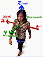
Almost all peoples past the Stone Age, in all areas, use relative directions, that is, directions from the “self,” as shown in the image to the left. But this idea is relative only to a person’s orientation and not used for permanent directions, as Sorenson claims. In fact, the Jewish word for “east” is qedem, which literally means “the direction of the rising sun.” However, we need to understand what this means. In our orientation, established by the Greek astronomer Ptolemy, we use north as our major orientation such as in maps which are always oriented to the north. On the other hand, the Jewish orientation (as well as the entire Middle East), uses east as their orientation point and all directions are oriented to this point; while in China, their orientation is to the south, which lies at the top of their maps.
For example, in Hebrew, one of the words for south is teyman from the root yaman meaning "to the right." The word qedem is also the word for the past. In the ancient Hebrew mind the past is in front of you while the future is behind you, the opposite way we think of the past and future. This is not so different than in English, where we think of north as the future, or focal point. As an example, anciently, the top, above, or upward, was the north point—which is the idea of up: “up the block,” “up north,” “going up to Ogden from Salt Lake City,” etc.
Also, in the Hebrew, a common phrase is "l'olam va'ed" and is usually translated in English as "forever and ever" but in the Hebrew it means "to the distant horizon and again" meaning "a very distant time and even further" and is used to express the idea of a very ancient or future time. Stated differently, time, as defined as the distance between two physical events, is not a physical measurement in and of itself. Yet in ancient Hebrew, time and distance refer to the same thing and literally to “the direction of the rising sun,” (which we would say, “In the direction of east”), means both the direction of east, and the origin of all things could have come, does come, and will come from the east.
The problem arises when Westerners try to think of Hebrew directional words, as Sorenson does, meaning more than how we would translate them in the West. Obviously, when Nephi wrote that they were headed nearly eastward (1 Nephi 17:1), he did not mean that his heading was in the direction of all things, now and in the past. But when Westerners try to go beyond the mark in translation understanding of the Hebrew, they often get into confusing territory and, in the case of Sorenson, goes far beyond the mark in trying to make east or eastward mean something else than the way it is translated. Thus, we can know for an assuredly that when Mormon called the eastern sea the East Sea or Sea East, we can be assured that he was not talking about the past, present or future when which all things come.
In addition, in Hebrew, while qedem is east, it is also antiquity, front, former estate, before, and in a broader sense, can also mean meet, confront, go before. Qedem is also the word for “the past, ancient time, aforetime.” But when qedem is used with a final he expressing direction toward, it should be compared with mizrah, meaning “where the sun rises,” which emphasizes location rather than direction. Stated differently, qedem can be used as a noun, abstract noun, or as an adjective. In the Old Testament, as an example, qedem is used 171 times, only 61 of those with the meaning of our “east,” 26 times meaning location (where the sun rises), 5 times meaning antiquity or former times, 69 times meaning the desert wind, east wind, etc., and 10 occasions meaning former times.
It is hard to imagine that Sorenson is able to determine that “east” in the Book of Mormon, written mostly by those who did not have a history with Hebrew among the Jews, and wrote in Reformed Egyptian, would try to tell us that this meant other than what we know it to mean.
When Nephi wrote about their traveling in the wilderness, he said, “nearly a south-southeast direction,” and “nearly eastward from that time forth,” all we have to do is compare his route of travel with a map of the Middle East and we find he used the exact, correct terms of our directional orientation. Yet he was traveling in an area in which he had never been, and when he turned eastward, was approximately along the 19º north latitude, with Bountiful along the southern Oman coast at about 21º north latitude. This is a difference of only 11º from Jerusalem. This is the same spread as Portland, Oregon, and Los Angeles, California, or Boise, Idaho, to San Diego, California. Having spent time in all these places, the sun’s swing, generally speaking, is close enough to being the same as to know the cardinal directions without problem. Certainly not to get them mixed up by 90º, which Sorenson’s map orientation does.
In addition, the major areas in Mesoamerica range from Mexico City area (19º north latitude—the same as where Nephi told us the correct compass direction along the Red Sea), to Guatemala City (14.6º north latitude), which is a swing from Jerusalem of between 13-degrees to about 17-degrees. It should also be understood that the latitude of the Mesoamerican Land of Promise from much of the Land Northward to much of the Land Southward, is along the basic same degree line of about 17º.  In addition, the area of Bountiful along the south Oman coast and that of the northern Yucatan (Sorenson’s Land of Promise) is the same latitude. The point of all of this is simply that is not a swing of the sun that would justify a 90º mis-orientation of the Land of Promise, and whatever Sorenson and others choose to say, does not change that one basic fact.
(See the next post, “The Narrow Neck of Land One More Time – Part VII—Mesoaermicanists’ Achilles Heel,” for more on this difficult area for the Mesoamerican Theorist model to reconcile with the scripture)

Monday, September 23, 2013

The Narrow Neck of Land One More Time – Part V—Mesoamericanists’ Achilles Heel

Continuing from the last posts showing the fallacy of the Mesoamerican Theorists’ view of the Isthmus of Tehuantepec in being the narrow neck of land—it becomes clear that this isthmus is the real Achilles heel of every Mesoamerican model. In pursuing this, the following is mostly from John E. Clark, himself a Mesoamericanist and follower of John L. Sorenson’s model, in which he defends the Mesoamerican Theory.
Clark’s argument follows:
1. “Sorenson's critics, insist that directions are universal absolutes that conform to American common sense. In this regard it is worth stressing that "common sense" is cultural code for culturally dependent knowledge that makes little sense outside one's own time or place.”
Response: Actually, “common sense,” is defined as “good sense and sound judgment in practical matters,” and also “sound practical judgment that is independent of specialized knowledge, training, or the like—normal native intelligence,” and “sound judgment derived from experience rather than study,” and “sound and prudent judgment based on a simple perception of the situation or facts.” It comes from the Latin sensus communis, meaning “common feelings of humanity.” Ralph Waldo Emerson (far leftg) made an issue out of the value of “common sense and common conscience,” Aristotle, Cicero, and Edison all spoke of its importance, as did Harriet Beecher Stowe, Thomas Payne, and Vladimir Nakokov. It can hardly be said that common sense “makes little sense outside one’s own time or place.” As Victor Hugo (left) said, “Common sense is in spite of, not the result of, education.”
As for the universal absolutes, all people think in terms of direction, either personal orientation (the way they are facing, etc.) or standard points (topographical compass points). It would seem that when a prophet (Mormon) wrote down “north” or “northward,” and another prophet, Joseph Smith (left), working under the influence of the spirit, wrote down “north” or “northward,” then it is only common sense that we understand this to  mean “north” or “northward” and not make an attempt to try and claim that these directions meant something else entirely--after all, Joseph Smith, and certainly the Spirit, would know the orientation of "north" in the same sense as we do. Of course, that’s my common sense, but to Clark, it “is cultural code for culturally dependent knowledge that makes little sense outside one's own time or place.”
2. “We may be tempted to think automatically that "northward" and "southward" label directions that are the same as "north" and "south." But "northward" signals a different concept than does "north," something like "in a general northerly direction." By their frequency of using the -ward suffix, we can infer that Mormon and his ancestors used a somewhat different cultural scheme for directions than we do. However, we cannot tell from the Book of Mormon text exactly how their concepts differed from ours, because all we have to work with is the English translation provided through Joseph Smith.”
Response: It would appear that the words north and northward are the same in the scriptural record. Take for instance Mormon’s comment regarding the division of the Land of Zarahemla from the Land of Nephi: “which was divided from the land of Zarahemla by a narrow strip of wilderness, which ran from the sea east even to the sea west, and round about on the borders of the seashore, and the borders of the wilderness which was on the north by the land of Zarahemla, through the borders of Manti, by the head of the river Sidon, running from the east towards the west -- and thus were the Lamanites and the Nephites divided” (Alma 22:27, emphasis mine).
Now here are three directions, north, east and west given in the singular term, describing a specific direction. In the following verse, the direction of west is used three times. Then in the following verse, the term northern is used to describe the same direction as north was used in vs 27: “the Nephites had taken possession of all the northern parts of the land bordering on the wilderness” (Alma 22:29, emphasis mine), which wilderness is that narrow strip of wilderness spoken of in vs.27. Also, in vs.29, the term west, east, and north are used again—north describing the same area as “northern.”
In addition, Bountiful was both northward and in the north. We see this in the statements: “on the north, even until they came to the land which they called Bountiful” and “Thus the land on the northward was called Desolation, and the land on the southward was called Bountiful,” also “that thereby they should have no more possession on the north, that they might not overrun the land northward” (Alma 22:33, emphasis mine). It can also be seen in: “he named all the land which was south of the land Desolation, yea, and in fine, all the land, both on the north and on the south -- A chosen land” (Alma 46:17, emphasis mine). And “he did not tarry in the land of Zarahemla, but he did march forth with a large army, even towards the city of Bountiful; for it was his determination to go forth and cut his way through with the sword, that he might obtain the north parts of the land” (Helaman 1:23, emphasis mine).
Also, while the Land Northward is generally called just that, we also see it referred to as the north: “there they did fortify against the Lamanites, from the west sea, even unto the east; it being a day's journey for a Nephite, on the line which they had fortified and stationed their armies to defend their north country” (Helaman 4:7, emphasis mine). “They did have an exceeding plenty of gold, and of silver, and of all manner of precious metals, both in the land south and in the land north” (Helaman 6:9, emphasis mine), and “the land south was called Lehi and the land north was called Mulek, which was after the son of Zedekiah; for the Lord did bring Mulek into the land north, and Lehi into the land south” (Helaman 6:10, emphasis mine), and “They did raise grain in abundance, both in the north and in the south; and they did flourish exceedingly, both in the north and in the south” (Helaman 6:12 emphasis mine).
Another example is found in Alma: “began in that same year to build many cities on the north, one in a particular manner which they called Lehi, which was in the north by the borders of the seashore” (Alma 50:15)
Then, in the following verse, the term northward is used: “And it bordered upon the land which they called Desolation, it being so far northward that it came into the land which had been peopled and been destroyed” (Alma 22:30, emphasis mine). Now in this statement, there are at least eight ways to say it:
1) it being so far northward
2) It being so far to the north
3) it being so far northwards
4) it being so far up north
5) it being so far toward the north
6) it being so far northbound
7) it being so far in the north
8) it being so far northwardly
Any one of these, and probably others, would convey the same meaning. Thus, to build an issue out of the "-ward" suffix in order to justify a completely different oriented land than that shown in the Book of Mormon is simply disingenuous.
(See the next post, “The Narrow Neck of Land One More Time – Part VII—Mesoaermicanists’ Achilles Heel,” for more on this difficult area for the Mesoamerican Theorist model to reconcile with the scripture)

Sunday, September 22, 2013

The Narrow Neck of Land One More Time – Part IV—Mesoamericanists’ Achilles Heel

Continuing from the last posts showing the fallacy of the Mesoamerican Theorists’ view of the Isthmus of Tehuantepec in being the narrow neck of land—it becomes clear that this isthmus is the real Achilles heel of every Mesoamerican model.
John E. Clark claims that John L. Sorenson has preserved the orientation of Mesoamerica in all of his arguments, and he has not, to Clark’s knowledge, altered even a single scripture to say that north was west or south was east. He makes this statement based on James Warr’s claim; however, what Clark seems to ignore is that Sorenson’s map ignores the directions of the scriptural record and he creates his own directions to match that of his model even though they are considerably different than Mormon’s description. Of course, Sorenson spends several pages trying to justify his model’s different directions, but it is really disingenuous of Clark to claim Sorenson didn’t change the scriptures—of course he did, perhaps not in the way Warr claims, but change them he did.
Take Mormon’s simple description of directions: “the land on the northward was called Desolation, and the land on the southward was called Bountiful” (Alma 22:31). In comparison take a look at Sorenson’s directions for his Land Desolation and his Land Bountiful:
On Sorenson’s map, yellow arrow points to his Land of Desolation, and the orange arrow points to his Land of Bountiful. As can easily be seen, they are west and east of one another, not north and south as Mormon describes
Now, in order to justify his east-west map to the scriptural record, Sorenson doesn’t change the scripture, he changes the knowledge of the Nephite people by claiming they thought west was north and east was south. Therefore Clark can say Sorenson didn’t change the scripture, however, as can easily he seen, Sorenson changed the meaning of the scripture. There is very little difference between the two. The same can be seen in Sorenson’s labeling a sea to the north as the East Sea, and a sea to the south as the West Sea. The problem is, from this point on, Sorenson never relates to the scripture again on these points, but relates to his map. This is both unscholarly and disingenuous! It is hidden behind the concept that “Sorenson does not assume that northward in the Book of Mormon is obvious, so it is not something that can be taken at face value. The problem resides neither in the manipulation of modern maps nor in ancient scripture but in the [reconciliation] of the two.”
On Sorenson’s map, yellow arrow points to his East Sea, and the orange arrow points to his West Sea. As can easily be seen, they are north and south of one another, not east and west as Mormon describes
The problem is, there is no need to reconcile the scriptures with a modern map. Book of Mormon scripture is accurate, modern maps may or may not be accurate for the Nephite time period. Even if Mesoamerica was the Land of Promise, which this example alone shows it is not, if we need to alter the meaning of a scripture, by claiming we know something the vast majority of readers does not, then we need to change our approach, or find some other way to explain the difference, which would be extremely difficult to do since Mormon (a prophet) and Joseph Smith (a prophet) and the spirit involved with both would have to be shown they are wrong in one way or another—and that is an issue that only a foolhardy man, or an arrogant man, would even think needed to be done, let alone make the attempt.
Every statement made about the Land Northward and the Land Southward and, indeed, their very names, show us that these lands were on a north-south directional line, but that does not agree with the Mesoamerican model, therefore, Sorenson needed to change the meaning of the directions so he could use his east-west map and model.
However, north is north, and the Land Northward is northward, and contains the lands of Desolation, Cumorah and many waters. The latter is so far north that “it bordered upon the land which they called Desolation, it being so far northward that it came into the land which had been peopled and been destroyed, of whose bones we have spoken” (Alma 22:30). Now Mosiah tells us about that land of bones: “And they were lost in the wilderness for the space of many days, yet they were diligent, and found not the land of Zarahemla but returned to this land, having traveled in a land among many waters, having discovered a land which was covered with bones of men, and of beasts, and was also covered with ruins of buildings of every kind, having discovered a land which had been peopled with a people who were as numerous as the hosts of Israel” (Mosiah 8:8).
Consequently, Mormon describes a Land of Promise that is oriented north and south. The problem is, Sorenson wants us to believe that Mosiah and Mormon, who had never been to Israel and, therefore, could not have been influenced by the etymology of Hebrew words, would not have thought to stand with their back to the sea and say they were facing east as Sorenson claims the Jews did in Jerusalem anciently. But that is Sorenson’s basic argument in changing the directions the Nephites knew and understood. To illustrate this change of direction, his map shows us a Land Northward to the west and a Land Southward to the east:
On Sorenson’s map, the yellow arrow points to his Land Northward, and the orange arrow points to his Land Southward. Note that these two lands are east and west of one another, not north and south as the scriptures state
The point is, Sorenson’s map does not agree with the descriptions of the Land of Promise found in the Book of Mormon. To illustrate this further, Sorenson has on his map that the Land of Many Waters is a great distance, about 250 miles, from his area of the Hill Cumorah, however, Mormon describes them in the same area, when he wrote: “And it came to pass that we did march forth to the land of Cumorah, and we did pitch our tents around about the hill Cumorah; and it was in a land of many waters, rivers, and fountains; and here we had hope to gain advantage over the Lamanites” (Mormon 6:4). Obviously, Sorenson’s locations are not consistent with Mormon’s description.
On Sorenson’s map, yellow arrow points to his Land of Many Waters, and the orange arrow points to the location of his Hill Cumorah. The distance is about 250 miles between these two areas, with his Hill Cumorah only about 100 miles form the narrow neck, and his Land of Many Waters about 350 miles from the narrow neck
As a side note, when Clark claims that Sorenson has not altered a single scripture, might it be noted that while the Flood of Noah’s time is dated in Genesis between 2344 and 2343 B.C. in the Bible and also in the Book of Moses, Pearl of Great Price, Sorenson uses the date of 3100 B.C. to agree with the Mayan calendar—I would say that this is changing scripture. To see all the scriptures Sorenson does alter, change, or try to explain away, see the book Inaccuracies of Mesoamerican & Other Theorists--there are so many it took an entire book to cover them.
In addition, in Clark’s evaluation of Joseph Allen’s Mesoamerican model, which differs from Sorenson’s model, he says: “Allen's proposed east sea is not associated with his proposed narrow neck. Allen identifies the Belize coast as the borders of the east sea but places the narrow neck at the Isthmus of Tehuantepec several hundred miles due west. This is poor logic and modeling. He can't have both.” We might say at this point, you can’t have Mesoamerica, an east-west orientation land, and the scriptural description of the Book of Mormon which describes the Land of Promise as a north-south oriented land. To do so is “poor logic and modeling, you can’t have both.”
(See the next post, “The Narrow Neck of Land One More Time – Part VI—Mesoaermicanists’ Achilles Heel,” for more on this difficult area for the Mesoamerican Theorist model to reconcile with the scripture)